PITTSBURGH — Localized flooding will be a concern again today with repeated rounds of showers and storms expected.
With near record levels of moisture available, any storm that develops this afternoon could produce tropical-like downpours. The heaviest rain is likely to develop after 3 p.m. and wrap up sometime this evening. Pockets of 1 to 2 inches of additional rain are expected.
A couple of strong storms are possible, too, with the main threat being strong wind gusts, although an isolated tornado can’t be ruled out.
Find live updates below.
4:27 P.M.:
4:22 P.M.: A Severe Thunderstorm Warning has been issued for central Westmoreland, southern Armstrong, southeastern Butler and Indiana counties until 5 p.m.
4:10 P.M.: A Severe Thunderstorm Warning has been issued for southern Fayette and southeastern Greene counties until 4:45 p.m.
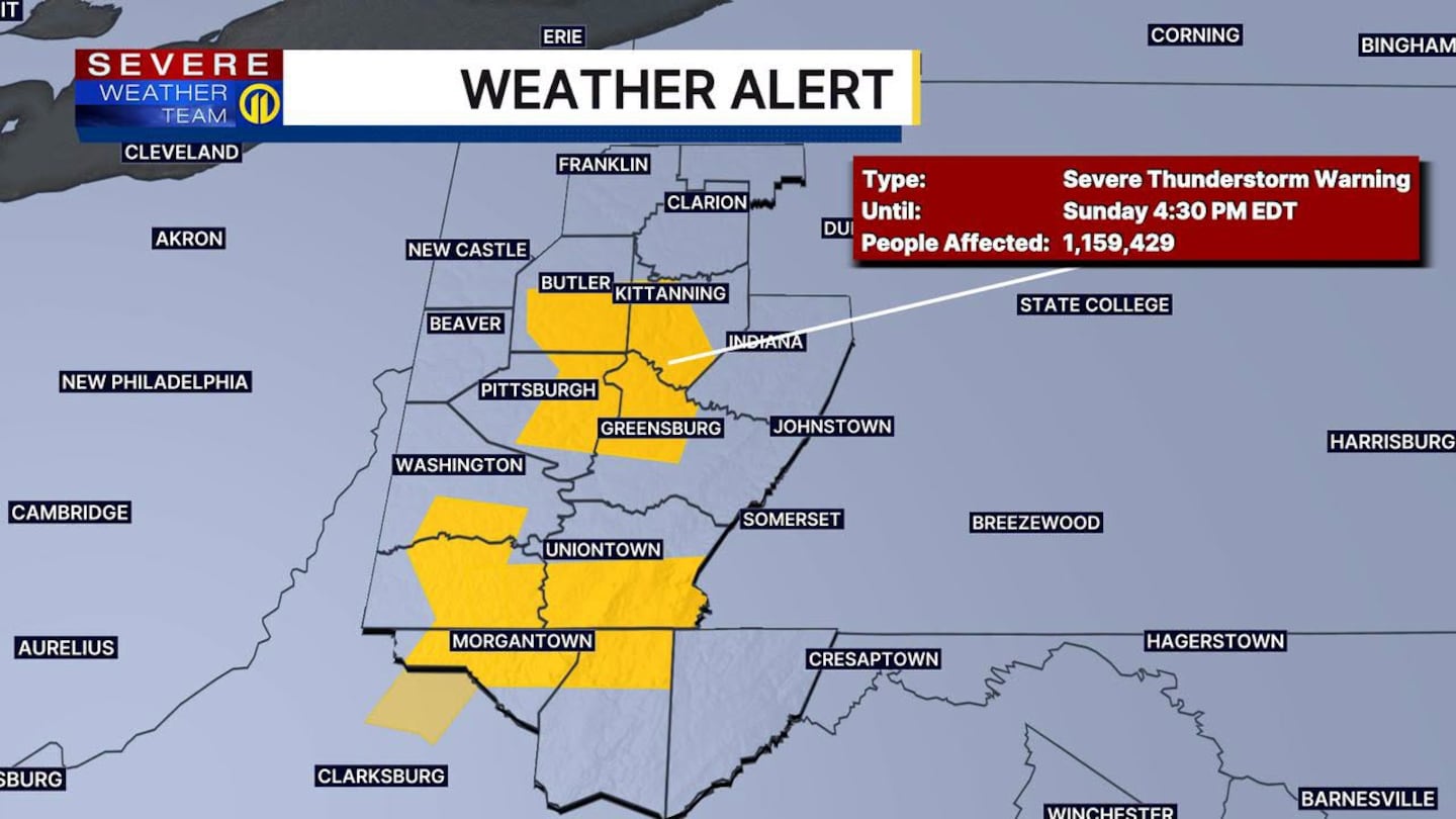
3:55 P.M.: Just over 7,500 households are without power as severe storms move through. Over 5,000 of those outages are in Allegheny County.
Click here to find the latest outage information from Duquesne Light Company
Click here to find the latest outage information from West Penn Power
3:45 P.M: The Tornado Warning in Butler County has expired. Severe Thunderstorm Warnings are still active.
3:42 P.M: A Severe Thunderstorm Warning was issued until 4:30 p.m. for Allegheny, Armstrong, Beaver, Butler, Lawrence and Westmoreland counties.
Some of the locations included in the alert are Pittsburgh, Ross Township, Bethel Park, Cranberry, Greensburg, Butler, Kittanning and Jeannette.
3:37 P.M.: The Pirates are now in a weather delay because of the storms. The Pirates were leading the Red Sox 7-3 before the delay.
3:32 P.M.: Beaver County was dropped from the Tornado Warning. The warning remains active in Butler County until 3:45 p.m.
3:27 P.M: Severe Thunderstorm Warning issued until 4:15 p.m. for parts of Greene and Washington counties, including the communities of Claysville, Waynesburg and Marianna.
3:25 P.M: Tornado Warning issued in parts of Beaver and Butler counties until 3:45 p.m. Communities included in this warning are Cranberry, Seven Fields, Evans City, Mars, Nixon and Callery.
3:18 P.M.: The Tornado Warning in Beaver County has expired. A Severe Thunderstorm Warning is still active in five counties until 3:45 p.m.
3:08 P.M.: A Severe Thunderstorm Warning was issued in parts of five counties until 3:45 p.m.: Allegheny, Beaver, Butler, Lawrence and Washington.
The City of Pittsburgh is included in the warning.
3 P.M: A Tornado Warning was issued for southern Beaver County until 3:30 p.m.
2:35 P.M.: A Severe Thunderstorm Warning was issued until 3:15 p.m. for parts of Beaver, Lawrence and Washington counties.
ORIGINAL STORY
Localized flooding will be a concern again today with repeated rounds of showers and storms expected.
With near record levels of moisture available, any storm that develops this afternoon could produce tropical-like downpours. The heaviest rain is likely to develop after 3 p.m. and wrap up sometime this evening. Pockets of 1 to 2 inches of additional rain are expected.
A couple of strong storms are possible, too, with the main threat being strong wind gusts, although an isolated tornado can’t be ruled out.
Spotty off-and-on showers are expected Monday, although additional rainfall amounts should be light. Humidity levels will drop throughout the day with sunshine and much more comfortable weather back Tuesday.
We’ll see another round of showers Wednesday afternoon into Thursday, although dry and less humid air looks to return Friday.
Download the FREE WPXI News app for breaking news alerts.
Follow Channel 11 News on Facebook and Twitter. | Watch WPXI NOW
©2026 Cox Media Group
/cloudfront-us-east-1.images.arcpublishing.com/cmg/XCUXZC2XYZHCRGNNGKFEX6U3LQ.png)


