PITTSBURGH — Today will be the best day to do any errands or put up any last-minute decorations. It’s cold this morning, but less wind is expected with temperatures pushing near freezing this afternoon.
Snow showers could be flying around Saturday morning with a leading disturbance, but only a coating at worst is expected. Steady snow pushes in during the afternoon, with the heaviest snow coming Saturday evening. Plan on snow-covered roads and dangerous travel conditions. Lake effect snow showers can be expected on Sunday, with combined totals ranging from 2 to 4 inches in Pittsburgh and upwards of 6 or 7 inches southeast into the mountains.
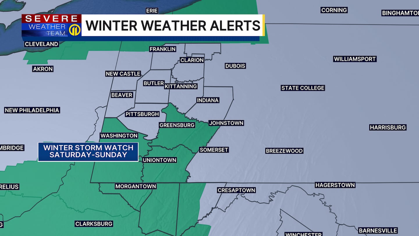
The cold and wind will be the bigger headline on Sunday, with sub-zero wind chills expected Sunday morning, especially north of Pittsburgh. Those numbers will barely improve throughout the day with air temperatures in the teens even on Sunday afternoon.
Cold weather will linger into Monday and early Tuesday before a nice warm up by the middle of next week! A light at the end of the tunnel!
Severe Weather Team 11 is tracking this snow system hour by hour and will bring you live forecast updates on Channel 11 News and on the Severe Weather Team 11 app.
Download the FREE WPXI News app for breaking news alerts.
Follow Channel 11 News on Facebook and Twitter. | Watch WPXI NOW
©2025 Cox Media Group
/cloudfront-us-east-1.images.arcpublishing.com/cmg/XCUXZC2XYZHCRGNNGKFEX6U3LQ.png)