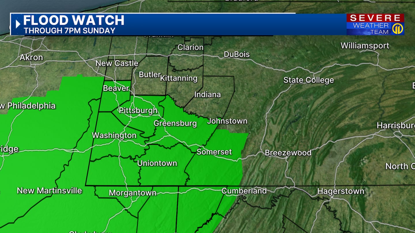
PITTSBURGH — Damp early this evening then steady to heavy rain is expected tonight through Sunday morning. A Flood Watch is in effect for Beaver, Allegheny, Westmoreland, Washington, Fayette, Greene counties and points south until 7 p.m. Sunday. Watch rising water in low-lying areas, creeks and streams, and watch ponding on roads. Take it slow and allow extra time. If you see rising water, get to higher ground and remember never drive through flooded roadways.
TRACK THE WINTER STORM WITH OUR INTERACTIVE RADAR
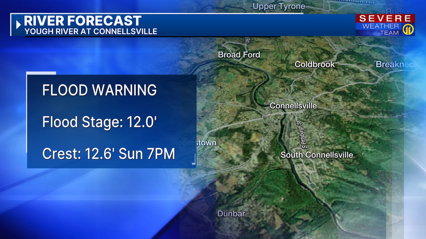
A Flood Warning has been issued for parts of the Youghiogheny River at Connellsville in Fayette County from Sunday afternoon through late Sunday night. The river is forecasted to crest above flood stage Sunday evening at 12.6′. Minor flooding is expected along the river. The next river update for this location will be issued Sunday morning.
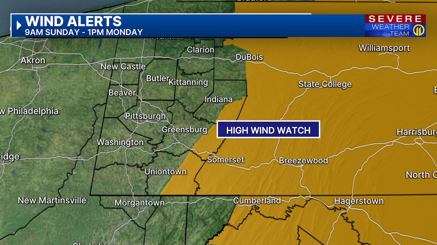
Temperatures will climb overnight into the 40s and even low 50s for some early Sunday morning. The warmer air is all ahead of a cold front that will also bring strong wind gusts and the chance for thunder as it passes through Sunday morning. Wind gusts could reach 30 to 40 mph on Sunday with higher gusts over 50 mph possible in the ridges and mountains. A High Wind Watch is in effect for the ridges of Westmoreland, Fayette and Indiana counties from 9 AM Sunday through 1 p.m. Monday.
The cold front will move through Sunday morning followed by crashing temperatures changing rain showers to steady snow showers early Sunday afternoon. Roads will turn colder Sunday afternoon and evening; snow will begin to stick and wet roads will turn icy. Scattered snow showers will continue at times Sunday night through Monday before dry weather returns by Tuesday. Locally snowfall accumulations could range from a coating up to 1″ to 2″ through Monday morning; higher amounts are possible in the ridges and mountains. A Winter Weather Advisory will go into effect at 1 p.m. Sunday through 3 p.m. Monday for ridges of Westmoreland & Fayette counties, eastern Monongalia and western Preston counties where snowfall could reach 2″ to 4″. Higher amounts are possible in the mountains with whiteout conditions due to high wind gusts in eastern Preston County and Garrett County where a Blizzard Warning will be in effect from Sunday afternoon through Monday afternoon.
The colder air that moves in behind this front Sunday will keep temperatures this week well below average.; highs will be in the 20s and overnight lows will drop to the single digits.
Make sure to check the latest forecast on Channel 11 News. Download the Severe Weather Team 11 app for the latest weather updates and alerts.
Download the FREE WPXI News app for breaking news alerts.
Follow Channel 11 News on Facebook and Twitter. | Watch WPXI NOW
©2025 Cox Media Group
/cloudfront-us-east-1.images.arcpublishing.com/cmg/XCUXZC2XYZHCRGNNGKFEX6U3LQ.png)


