This unsettled weather pattern continues through the start of the weekend with more rain to come today and the chance for strong to severe storms into early Friday morning. — This unsettled weather pattern continues through the start of the weekend with more rain to come today and the chance for strong to severe storms into early Friday morning.
It will be warm and muggy with isolated showers and thunderstorms on Wednesday with highs reaching into the 70s. Slow-moving downpours are likely later this afternoon and through the evening, especially in our eastern counties and in the mountains.
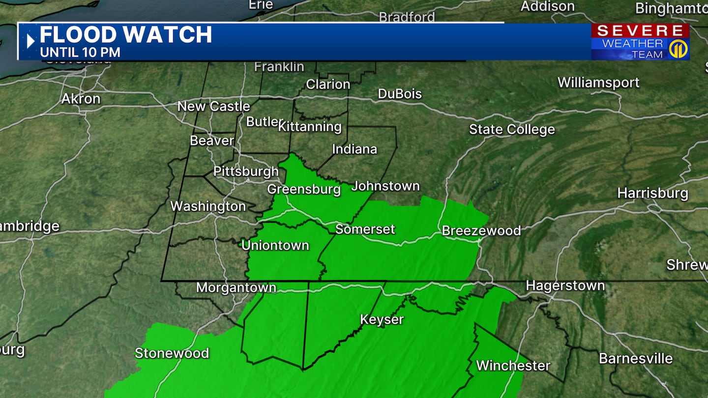
After heavy rainfall yesterday and with the potential of more heavy rain again today, a Flood Watch has been issued for Fayette and Westmoreland counties in PA along with portions of eastern Monongalia, Preston, and Tucker counites in WV and Garrett county in MD until 10PM tonight. Watch low-lying areas, flood-prone locations and the rise on creeks, streams and rivers. If you see rising water, make sure to get to higher ground and never drive through flood waters.
Warm and muggy weather ends the week with highs in the low 80s. The threat for severe thunderstorms are possible late overnight Thursday into Friday morning. Severe storms could bring damaging winds, large hail, isolated tornadoes and heavy rain that could lead to flooding concerns. Make sure you have a way to get weather alerts during the overnight hours for early Friday morning.
Make sure to check the forecast often through the week for the latest on the threat for severe weather on Channel 11 News. Don’t forget to download the Severe Weather Team 11 App for the latest weather updates and alerts.
Download the FREE WPXI News app for breaking news alerts.
Follow Channel 11 News on Facebook and Twitter. | Watch WPXI NOW
©2025 Cox Media Group
/cloudfront-us-east-1.images.arcpublishing.com/cmg/XCUXZC2XYZHCRGNNGKFEX6U3LQ.png)


